
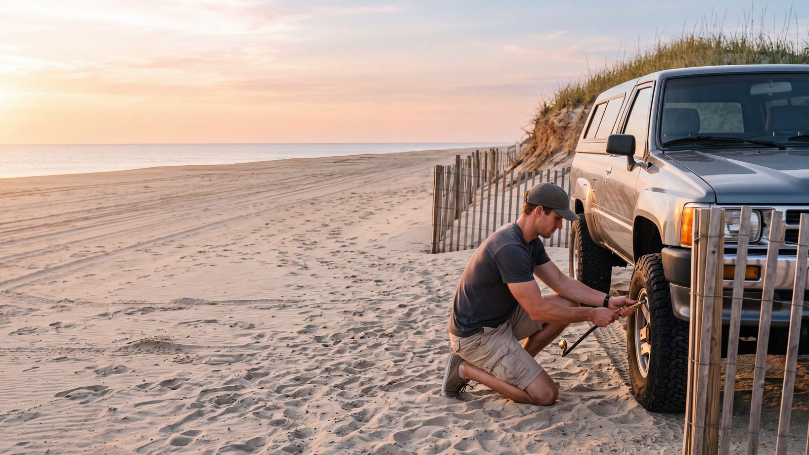
Outer Banks 4x4 beach access is legal only in marked ORV zones, and this map shows every ramp from Corolla to Ocracoke along with where permits are required. Use it to plan where you can air down and drive before you go.
Virginia line to Ocracoke
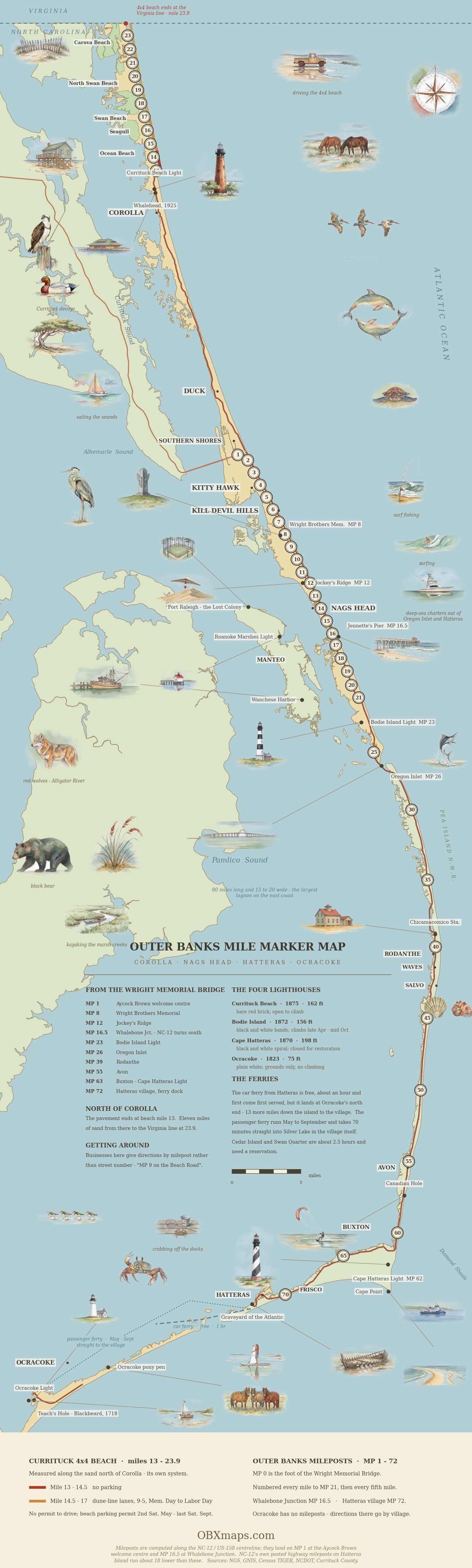
The Outer Banks Mile Marker Map
Every milepost, the four lighthouses and the landmarks, end to end — including the eleven miles of drivable sand north of Corolla and the ORV stretches down Hatteras.
If you are running the 4x4 beach north anyway, The End of the Road turns that drive into a self-guided investigation — the Corolla ramp north past Penny’s Hill and Swan Beach to the Virginia line. There is a dog-friendly one too, Off-Roading with Fido.
Driving on the beach is one of the signature Outer Banks experiences, but you can only do it legally in specific areas, through marked off-road-vehicle (ORV) ramps, and — in most cases — with a permit. This map and guide pull together where the 4x4 beaches are, how the ramp system works, and what you need before you air down and hit the sand.
Ramp by ramp. Our sister site has a full guide to each Cape Hatteras ramp with hours, parking, seasonal dates and what is nearby: Ramp 2, Ramp 4, Ramp 23, Ramp 25, Ramp 27, Ramp 30, Ramp 32, Ramp 34, Ramp 38, Ramp 44, Ramp 43, Ramp 49, Ramp 48, Ramp 55, Ramp 59, Ramp 63, Ramp 67, Ramp 68, Ramp 70, Ramp 72. Two that confuse people: Ramp 48 has no turnoff from NC 12 — you reach it along the Inside Road, which branches off Ramp 49 near the Frisco Campground — and Ramp 45 is not a driving ramp at all, but a walking path from Cape Point Campground to the beach, about a mile and a half each way.
Take it with you. Cell signal thins out on the Carova sand and south of Salvo. Open the same map in Google Maps and save it to your phone before you air down.
Where You Can Drive on the Beach
Save this map to your phone for offline use
Every numbered ramp has its own detailed guide — directions, closures, and what’s nearby — at our sister site Outer Banks Beach Driving. Ramps close seasonally for bird and turtle nesting, and seasonal night-driving hours apply and vary by ramp and month — most ocean-side ramps close at 9 p.m., with priority ramps reopening earlier in the morning than others, while sound-side ramps stay open 24 hours. Because closures shift with wildlife nesting and conditions, always check today’s official NPS ramp status before you enter the beach.
There are three main 4x4 beach driving zones on the Outer Banks. The northern beaches above Corolla (Swan Beach and Carova) are reached from the ramp where NC-12 ends. Cape Hatteras National Seashore — spanning Bodie Island, Hatteras Island, and Ocracoke — has the largest network of numbered ORV ramps. Nags Head, Kill Devil Hills, Kitty Hawk and Southern Shores each allow off-season beach driving in designated areas, with their own permits and their own dates. A Cape Hatteras ORV permit costs $50 for 10 consecutive days or $120 for the year, sold only through Recreation.gov.
The Carova / North Beach 4x4 Area
North of Corolla the pavement ends and the beach becomes the road. No permit is required to drive here, but Currituck County requires a $50 weekly permit to park on the sand from the second Saturday in May through the last Saturday in September — only 300 are sold a week, and they go on sale April 1. Three county rules catch people out: no parking at all in the first 1.5 miles north of the ramp, the dune-line driving lane between Milepost 14.5 and Milepost 17 from 9 a.m. to 5 p.m. in season, and 35 mph dropping to 15 mph within 300 feet of anyone. The terrain is unforgiving: deep soft sand, no services, and tides that can cut off the drivable beach. This is wild-horse country and pure 4x4 territory.
Cape Hatteras National Seashore ORV Ramps
The National Park Service maintains numbered ORV ramps from Oregon Inlet down through Hatteras Island and onto Ocracoke. Popular access points include the ramps near Cape Point in Buxton (a famous surf-fishing spot) and the South Point on Ocracoke. A National Park Service ORV permit is required, and seasonal closures protect nesting birds and sea turtles — always check current ramp status before you go.
What You Need to Drive the Beach
At a minimum you need genuine four-wheel drive, the ability to air your tires down to roughly 18–20 psi for flotation, a tire gauge and a way to re-inflate, and basic recovery gear (a board or traction mat and a tow strap). Front-wheel-drive crossovers and “soft-roaders” get stuck constantly — this is real soft-sand driving.
Don’t Have a 4x4? Rent One Built for the Sand
If your vehicle isn’t equipped for soft sand, renting is far smarter than risking a costly tow off the beach. Beach4x4, our 4WD rental company in Kill Devil Hills, rents Jeeps and 4x4 SUVs for OBX beach driving. Their rentals include the Currituck County seasonal beach-parking permit and the Cape Hatteras National Seashore ORV permit, a tire-pressure gauge, a portable compressor, and recovery gear. Renters air down to 18-20 PSI at the ramp and bring the tires back up to 38 PSI before returning to pavement.
Before You Go
- OBX Tide Charts — never drive the beach without checking the tide; high tide can trap you.
- Outer Banks Maps — the full map directory.
- Outer Banks Surf Fishing — most beach drivers are headed out to fish.
- Beach4x4 — rent a 4x4 ready for the sand.
Facts on this page last verified: August 2026.
Where can you drive a 4x4 on the Outer Banks?
There are three main 4x4 beach driving zones: the northern beaches above Corolla (Swan Beach and Carova), reached where NC-12 ends; Cape Hatteras National Seashore, which spans Bodie Island, Hatteras Island, and Ocracoke and has the largest network of numbered ORV ramps; and the central beach towns — Nags Head, Kill Devil Hills, Kitty Hawk and Southern Shores — which allow off-season beach driving in designated areas, each with its own town permit and dates.
What do you need to drive on the beach at the Outer Banks?
At a minimum you need genuine four-wheel drive, the ability to air your tires down to roughly 18-20 psi for flotation, a tire gauge and a way to re-inflate, and basic recovery gear such as a traction board or mat and a tow strap. Front-wheel-drive crossovers and soft-roaders get stuck in the soft sand. You also need an ORV permit in most areas, including Cape Hatteras National Seashore.
Do you need a permit to drive on Carova Beach?
No driving permit is required. However, a Currituck County beach parking permit is required to park on the beach during the summer season (roughly mid-May through late September). The terrain is unforgiving, with deep soft sand, no services, and tides that can cut off the drivable beach. By contrast, Cape Hatteras National Seashore does require a National Park Service ORV permit, and seasonal closures there protect nesting birds and sea turtles, so always check current ramp status before you go.
Which App Should You Run on the Sand?
This map shows you where the accesses are. On the beach itself, the app on your dash decides what you can see — and they do not all carry the ramps, let alone the corridor between them. onX Offroad vs Gaia GPS vs the free Park Service map, compared for Outer Banks sand, including why none of them knows today’s closures.